Current Projects
Development of a Frequency-Modulated Continuous Wave (FMCW) Maritime Lidar System
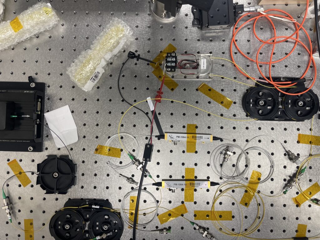
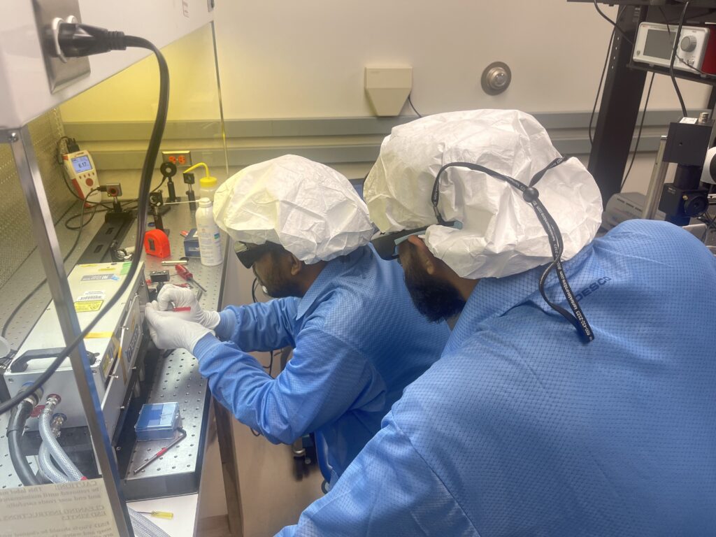
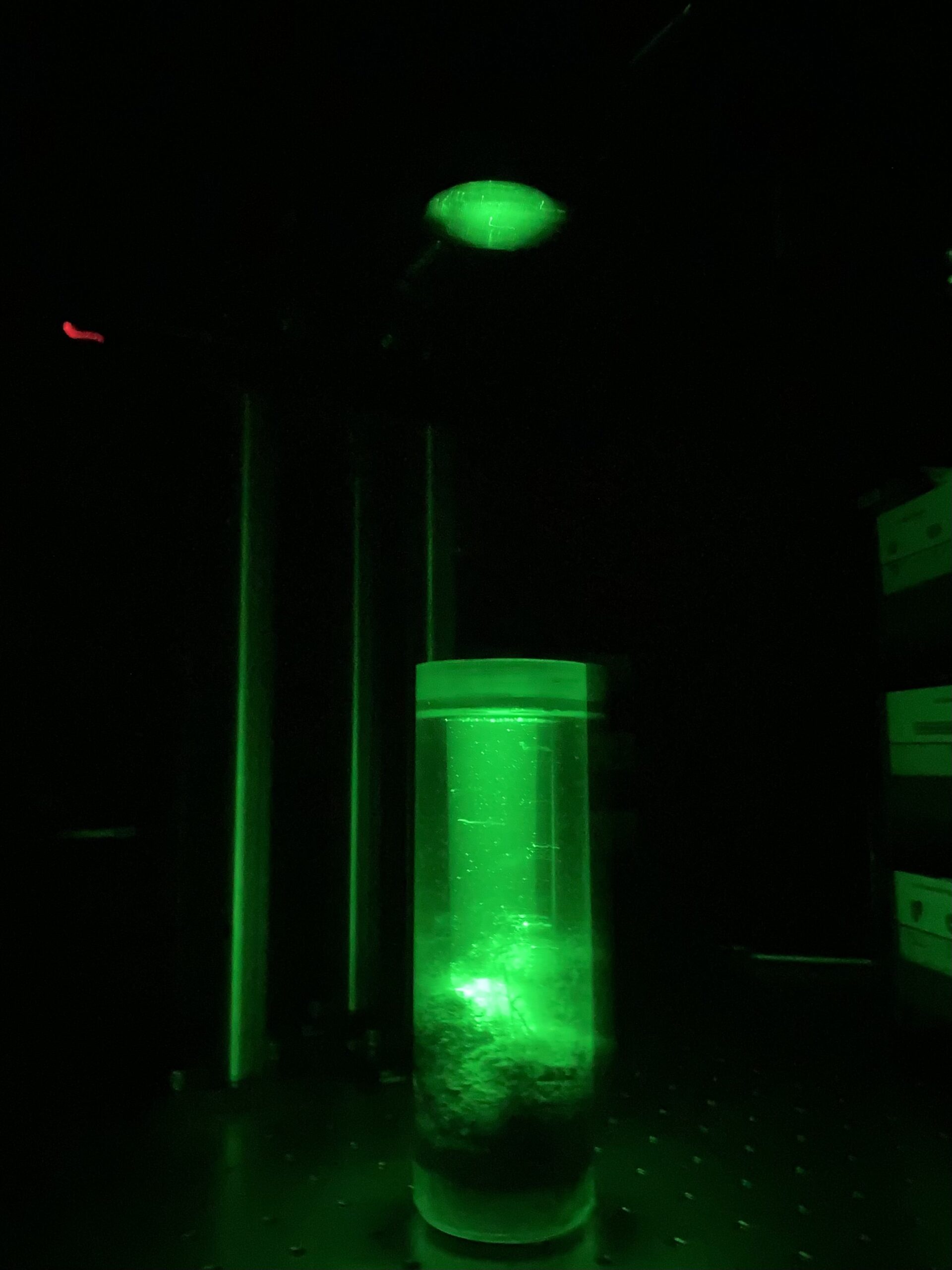
This project is developing a novel coherent lidar system at 532 nm to enable high-resolution profiling of the underwater environment. Coherent lidar enables range resolutions not possible to achieve with conventional incoherent lidar. This system is designed to have a range resolution in water of 2 mm. The end goal is a breadboard demonstration system to enable further studies. This project is supported by the Geophysical Institute.
Development of a droneborne maritime lidar system
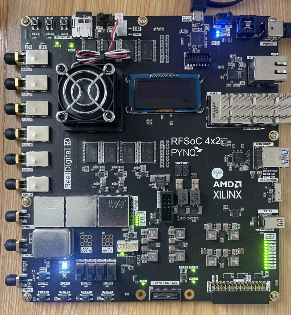
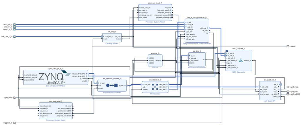
This project is developing a new maritime lidar system to operate on a fixed-wing drone platform to enable new studies in Alaska and beyond. This lidar will have many applications including salmon counting, profiling phytoplankton density for salmon hatcheries, and monitoring coastal erosion and changes in bathymetry. The heart of the system is AMD’s state-of-the-art RF system-on-chip (RFSoC) platform, which includes hardware fabric, an ARM quad-core processor, and high-speed digitizers. The RFSoC miniaturizes what in previous airborne systems took an entire rack of equipment and a laptop to a single chip which can fit on the droneborne platform. This project is supported by the Army Corps of Engineers and Alaska Space Grant.
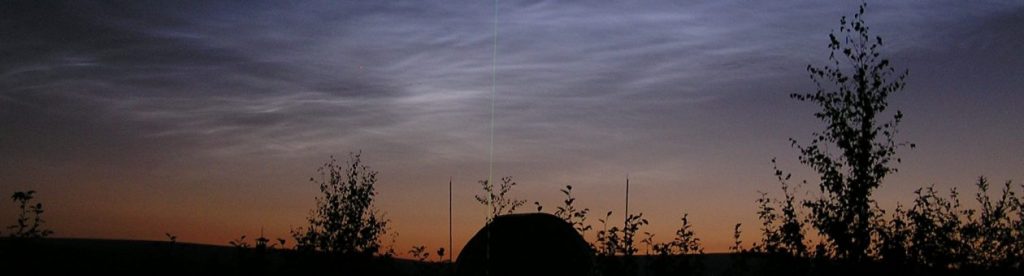
Development of an Iron Resonance Lidar at the High-Frequency Active Auroral Research Program (HAARP)
We are establishing a new resonance lidar system at HAARP to probe the iron metal layer in the mesosphere from 80-120 km. This lidar will retrieve high-resolution wind, temperature, and neutral metal measurements in coordination with the established ionospheric research instrument (IRI). The new lidar will be all solid-state, an enabling technology for future space-based measurements. This project is supported by the NSF.
Fluorometer Detection of Benthic Phytoplankton
This project is a proof-of-concept study to test the remote detection of benthic phytoplankton with a fluorometer. Benthic phytoplankton are phytoplankton which live on the bottom of lakes. In general, they greatly outnumber the phytoplankton which live in the water column but are currently neglected in studies of primary productivity. To close this gap we are building a proof-of-concept fluorometer to detect and map their spatial extent. The eventual goal is to mount the fluorometer on an autonomous underwater vehicle (AUV) to map the spatial extent of benthic phytoplankton in the Great Lakes. This project is being led by Dr. Roddewig.
Past Projects
Improving Satellite-Based Remote Sensing of Inland Water Bodies and Harmful Algal Blooms
This project is a study of using low-cost polarization imagers to measure chlorophyll in inland water bodies. Current satellite remote sensing methods for the measurement of chlorophyll use radiometric measurements which neglect polarization. These methods work well in the open ocean but struggle in coastal and inland water where the water is more optically complex. Polarization intrinsically provides greater information than radiometric measurements alone and has been shown to have potential for improving measurements of chlorophyll in optically complex water. In this project, Dr. Roddewig is collaborating with researchers from Montana State University and the University of Montana Flathead Lake Biological Station to test the use of polarization to measure chlorophyll in Flathead Lake in Montana.
Lidar Studies of Coupling in the Arctic Atmosphere and Geospace (LCAGe)
The LCAGe project focuses on understanding the coupling between terrestrial weather and space weather based on lidar observations of the Arctic mesosphere and lower thermosphere. A new sodium resonance wind-temperature lidar (SRWTL) was installed at LRL-PFRR in November 2017. The SRWTL will provide high resolution measurements of the meteorology that will be combined with other measurements made by complementary lidars, radars, and imagers at PFRR. The project involves researchers from UAF and GATS, and students from UAF. This investigation was supported by the NSF.
For more information: NSF LCAGe Page
Transport, Chemistry, and Energetics of Water in the Mesosphere and Lower Thermosphere (SuperSoaker)
The SuperSoaker experiment was designed to investigate the impact of a water release on the atmospheric environment. The experiment combined a water release with ground-based lidar measurements that measured the cloud formed by the water release. The experiment was conducted in January 2018 at PFRR. The experiment involved researchers from six institutions (ASTRA, Clemson, GATS, NRL, UAF, and USU), staff from UAF and NASA, and students from UAF and USU. This investigation was supported by NASA.
For more information: NASA WFF SuperSoaker Page
Mesosphere Lower Thermosphere Turbulence Experiment (MTeX)
The MTeX experiment investigated the relationships between turbulence, waves, and instabilities in the Arctic stratosphere-mesosphere-thermosphere. The experiment combined rocket-based ion-gauge measurements of turbulence with ground-based lidar measurements of waves and instabilities. The experiment was conducted in January 2015 at PFRR. The experiment involved researchers from seven institutions, staff from UAF and NASA, and students from UAF, Clemson, and Embry-Riddle. The MTeX measurements found low levels of turbulence that coincided with low levels of wave activity, and suggest that turbulence activity may be systematically low in the Arctic associated with systematically low levels of wave activity in the Arctic. This investigation was supported by NASA.
For more information:
MTeX Launch Facebook Page
SPIE News Room Article on MTeX
NASA WFF MTEX Page
Wave Driven Circulation and Variability of the Arctic Atmosphere (ArcWAVE)
The ArcWAVE project focused on understanding the wave-driven circulation and variability of the Arctic atmosphere. his study drew on lidar, reanalysis and satellite observations to understand the interactions between gravity waves, planetary waves, and the mean flow. The study found systematic interannual variability in gravity wave activity, with primary control of the wave activity by the mean flow. Secondary control was found due to unbalanced flow. The project involved researchers from UAF and CU, and students from UAF.
This investigation was supported by NSF.
For more information:
NSF ArcWAVE Page
GI-UAF ArcWAVE Page
Arctic Data Center ArcWave Page
ArcWAVE Publication Triplett et al., 2017
ArcWAVE Publication Chandran et al., 2014